


University of Central Arkansas geographers received a $40,000 grant from NASA to study how the Arkansas Delta’s declining fresh groundwater used for agricultural irrigation impacts the regional climate and crop yields for farmers.
The study is led by Yaqian He, Ph.D., an assistant professor of geography, and Matthew Connolly, Ph.D., an associate professor of geography.
“We want to assess how irrigation interacts with regional climate (e.g., reduced temperature because of more irrigation water evaporating into the atmosphere) and how the changed regional climate because of irrigation, in turn, affects crop yields that farmers concern most. We then build a benefit/risk map to show farmers where irrigation-climate interaction will promote/harm crop productivity. Based on that information, farmers may consider changing their irrigation strategy,” Dr. He said.
After submitting a proposal to Arkansas NASA’s Established Program to Stimulate Competitive Research (EPSCoR), the UCA research team received the grant.
“Each year, Arkansas NASA EPSCoR office will release a ‘Call for Proposals (CFP)’ for research infrastructure development (RID) grant. Faculty members in Arkansas who feel their research is suitable for the CFP’s theme can apply for it. The applicants need to prepare the proposal about research questions, methods, expected outcomes, etc. They also need to prepare a budget, its justification, and other required documents,” Dr. He said.
Dr. He and Dr. Connolly hired two undergraduate students, geography major Marisol Filares and environmental science major Caden Rhodes to join the team.
“This research project deepened my understanding of the collection of spatial data as well as introduced me to coding languages to manage large amounts of data. It also allowed me to become a remote drone pilot where I learned about regulations in airspaces and interpreting Metrological Aerodrome Reports (METARs) and Terminal Aerodrome Forecasts (TAFs),” Filares said.
The grant allowed each research team member to attain the Federal Aviation Administration’s remote pilot certification needed to fly a drone.
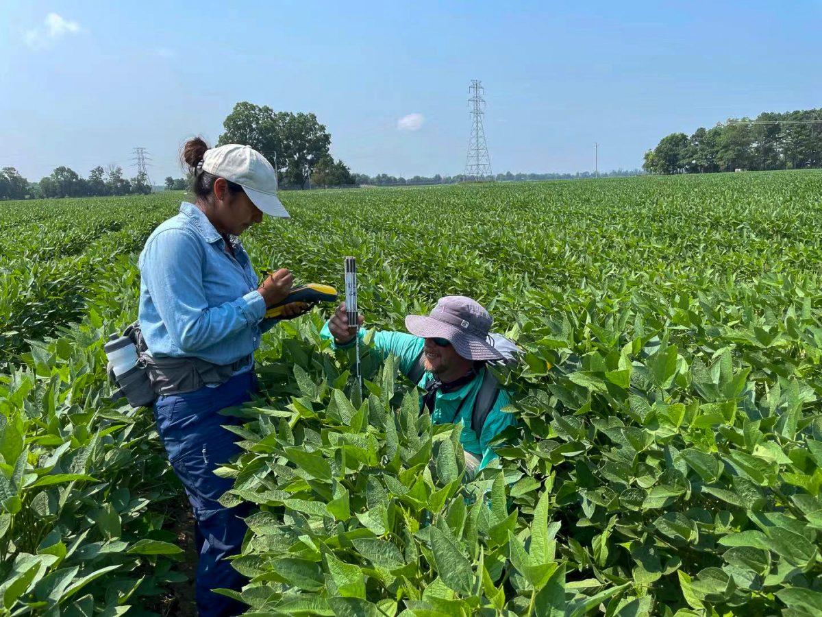
“We planned and executed our drone flights during Summer 2021 to collect imagery for irrigated and non-irrigated soybean fields in Jackson County, Arkansas,” Dr. Connolly said.
“We used drones to fly over the irrigated soybean and non-irrigated soybean fields to get the drone images. These drone images will be used as training samples in a machine-learning algorithm and combined with satellite images to classify the irrigation and non-irrigated soybean over the Delta region. This work is ongoing now,” Dr. He said.
“We collected the imagery data during the summer because we needed to capture images when the soybean plants were actively growing and consuming water. After finishing the fieldwork, we processed the drone imagery at UCA to create maps of the irrigated and non-irrigated soybean fields,” Dr. Connolly said.
Rhodes created an interactive map that compiles preliminary results of the study that farmers can use to determine how often to irrigate farmland in the Delta.
“The map that Caden created can exactly show the farmers where their irrigation-climate interactions benefit/risk their crop productivity. Farmers in the risk counties are encouraged to learn the irrigation strategy from the farmers who are in the benefit region. If we get further funding, we will interview farmers in risk/benefit counties and then provide the best irrigation strategy to all farmers directly,” Dr. He said.
Studying how the Arkansas Delta’s groundwater used for irrigation changes the regional climate and crop yields is important due to the economic importance of agriculture.
“Using groundwater for irrigation generally changes the moisture balance in the atmosphere and the ground and alters soil chemistry. Pumping groundwater for crop irrigation removes water from the soil and adds water to the atmosphere. Over time adding water to the atmosphere can change local temperatures and local rainfall patterns. Temperature and rainfall (precipitation) are the variables that directly affect and define a place’s climate, so changing the average temperatures and average rainfall can effectively change climates,” Dr. Connolly said.
“Local changes in a relatively small area can create a microclimate. Microclimates are areas with distinctly different temperature and rainfall characteristics than areas nearby,” Dr. Connolly said.
Results from the UCA research team’s study will help farmers determine how frequently to irrigate farmland.